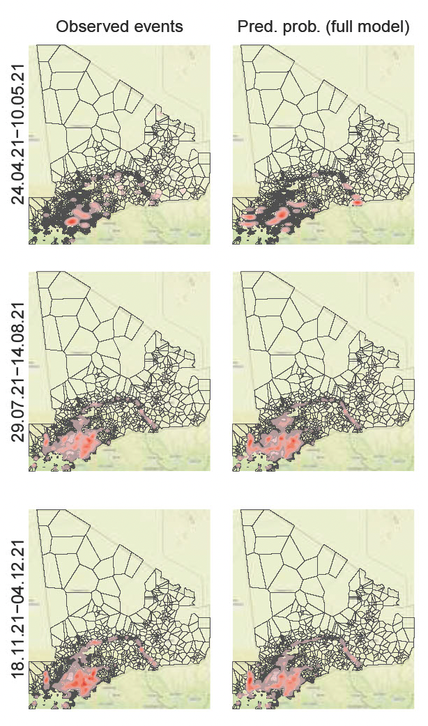
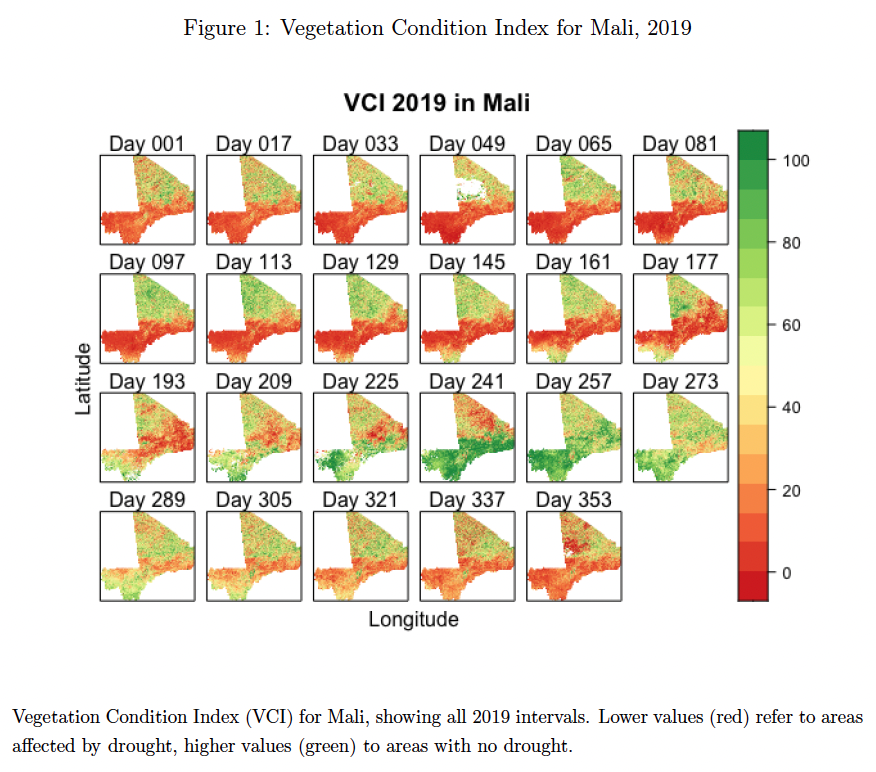
(under review, co-authored with Christoph Dworschak) Go where you are needed: Improving early warning systems in UN peacekeeping through remote sensing data.
UN peacekeeping missions increasingly rely on Early Warning Systems (EWS) to protect civilians through targeted patrolling and anticipatory action. However, existing forecasting approaches used by academics and practitioners are largely reliant on information gathered by human intelligence, including news reports, which are prone to various biases. In addition, many approaches employ complex estimation techniques or operate at a high level of temporal and spatial aggregation. They also tend to add noise by pooling together various forms of violence which originate from different data generating processes. All these limitations severely inhibit their usefulness in providing actionable information and facilitating humanitarian efforts on the ground. Borrowing from existing humanitarian techniques usually employed for needs assessment, we propose an integrated EWS that draws on highly disaggregated remote sensing data to forecast inter-communal conflict. These data offer detailed bi-weekly information on vegetation cover which relates to latent and practically relevant vulnerabilities, including pastoralist movements, developments in agriculture and lumbering, migration, and aridification. We show how using these data in off-the-shelf estimation techniques that have low barriers to implementation significantly contributes to our ability to forecast violent events in communal conflict.